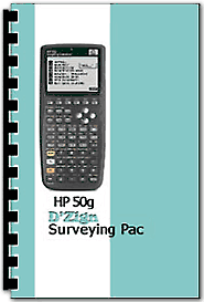
D'Zign Surveying Pac Software v2 for HP-50G Calculator
Discontinued Item - unlikely to be stocked again.
New Version 2 features an improved file system and a lower price due to removal of the Converter application which is now sold separately.
The Surveying Pac for the HP 50g is meant for general use by the professional or sub-professional surveyor, and contains all of the programs for Coordinate Geometry, curves, triangle and spiral solutions that are in the Basic Cogo+ Pac, supplemented by additional solution programs such as curve common to three tangents, curve through three known points. These are then augmented by field stakeout programs and leveling programs.
In general, it's fair to say that you can stake anything from anywhere with this program.
The radial stakeout features allow either azimuth or angle-right calculations for the direction, and contain a come-go option that is quick and simple. You can work directly from stored point files or you can input the coordinates as you go. With the increased use of GPS for design topography, you will often find yourself staking from plans that are based on state plane coordinates. We included a softkey for setting a grid-to-ground distance adjustment for your staking distances.
All of our software pacs have extended parameter options, allowing you to set the number of decimal places you want to display in each type of output. This includes coordinate, distance, elevation, area, angle output and even lets you set your preferred default stack setting.
Important: Comes on a 64MB Secure Digital card for use with the HP-50G Calculator. The card also provides the user with about 60MB of usable backup memory. Once activated, the card cannot be shared with multiple calculators.
